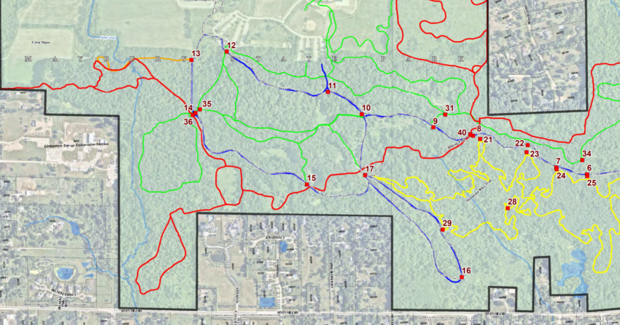
Assessing

Street Map Development | City of Plymouth, MI

City of Plymouth (MI) updates printable street map and centerline data for Public Safety. This base map layer is utilized throughout the organization. Data for street names to provides current street locations with corresponding subdivisions and sections.
Read More
Cart

No products in the cart.

Select the fields to be shown. Others will be hidden. Drag and drop to rearrange the order.
  • Image
  • SKU
  • Rating
  • Price
  • Stock
  • Availability
  • Add to cart
  • Description
  • Content
  • Weight
  • Dimensions
  • Additional information
  • Attributes
  • Custom attributes
  • Custom fields
Click outside to hide the compare bar
Compare
Compare ×
Let's Compare! Continue shopping